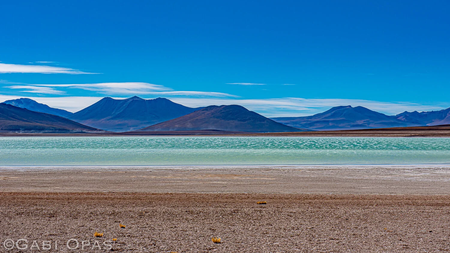
A rugged exploration of the alien landscape of the Bolivian Altiplano
Exactly 1 year ago, Dan and I embarked on a 3 week adventure to Bolivia. We were completely – and literally off the radar – with no cell phone or GPS signal to guide us. Navigating was a challenge, even with the military-grade maps we managed to get our hands on. Starting today I will be posting a few photos everyday to take you along our amazing journey navigating backcountry dirt roads, hiking rainbow volcanoes, and spotting wildlife in the colourful lagoons.
We wouldn’t have been able to get off the beaten path without renting a 4x4. We decided to fly from La Paz to Uyuni to save a day of driving. From there we rented a car and returned it in La Paz almost 3 weeks later. We had a general idea of where we wanted to go - but most of the trip was improvised on the go and we would drive until we would see a good spot to set up camp.
One of the first things we did when we arrived in La Paz was to look for a map of the Bolivian Altiplano. As always we had our go-to Lonely Planet guide but we needed something a little more detailed. After visiting a few bookstores which were not of much help, Dan insisted we try the Military Geographical Institute. I was a little sceptical that a Bolivian Military base would grant access to foreigners, but after a quick security check, they let us in and we strolled through the military barracks. Luckily Dan speaks Spanish fluently so after a few smiling exchanges, they brought out a comprehensive map of the Altiplano and we were set. Before heading out the Bolivian soldier gave us his number and told us if we ran into trouble to contact him. No better way to start a trip than with a military map in your pocket and a direct line with the Bolivian military.
DAY 1: La Paz
We flew into the El Alto International Airport in la Paz which is the highest international airport at an altitude of 4061.5 meters. We had a day to get over our jet-lag, prepare for our trip, and explore the city a little. As we landed, we could see that the city had a unique topography, buildings overflowing from a large valley over steep slopes and ridges. Since we had a day to get over our jet-leg and explore the city, we hopped on their revolutionary sustainable public transit which comprises of the world’s longest urban cable aerial car system. Not only does it avoid chaotic traffic and pollution, it also runs on electricity and solar power. Added bonus: amazing bird’s eye view of the city and surrounding mountains.
Day 2: Salar de Uyuni
If you’re starting your journey in Uyuni you really start out with a bang. As soon as you see the salt flats of Uyuni, which are the largest in the world, you are immediately transported to another galaxy, another dimension. April is the end of the wet season and beginning of the dry season in Bolivia, so we were lucky to see the salt flats with two personalities – from dry desert-like patterns to the crystal-clear reflective mirror. Standing on an infinite mirror felt like I was a character in a Star Wars movie – only later to find out they had actually filmed there!
Day 3: Valle de Rocas
On our 3rd day we arranged to pick up our 4x4 car rental and given the desolation of the area we planned to explore, had to pickup all food and supplies for the following two weeks. We bought some food at the local market, tanked up 3 extra jerrycans of gas that we strapped to the roof and headed out into the unknown. We quickly learned that even with the military map in hand, navigation was not going to be that simple. Roads marked as “two-way paved highways” in reality were at best a narrow dirt roads and there was absolutely no signs in sight, so we had to make calculated estimations based on distances and gps phone signals, which were not always accurate or even attainable. This resulted in a few backtracks or detours. The drone did save us navigating through the canyons surrounding Uturuncu volcano the following day. It felt like we were discovering a new land on our Mars rover, exploring a vast largely uninhabited plains, with the sighting of an occasional timid llama or vicuna or other wildlife unaccustomed to human travel.
As the sun began to set, we took an even smaller dirt road off the “main” road to find a camping spot. We made our way to some rock formations, hoping to find a spot shielding from the wind. As we set up our tent and climbed up to the top of a rock to scope out the area, we discovered an opening to a huge canyon. As we watched the sunset, the moon rose and the rocks glowed in the golden light.
Day 4: Laguna Celeste
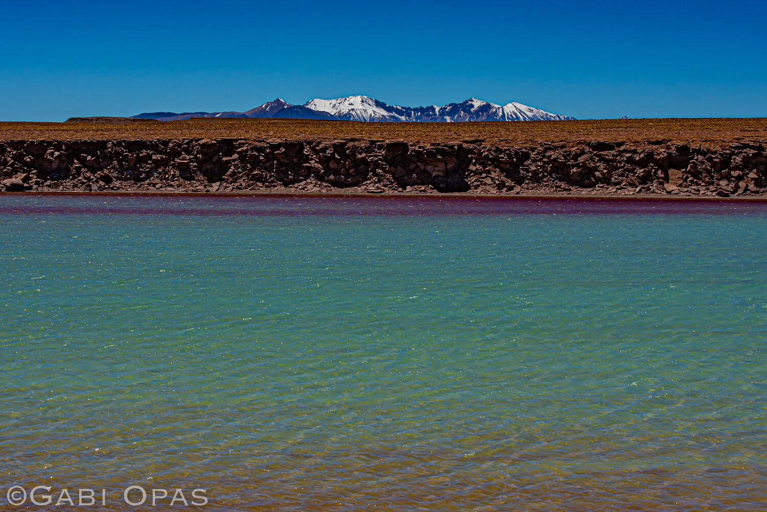
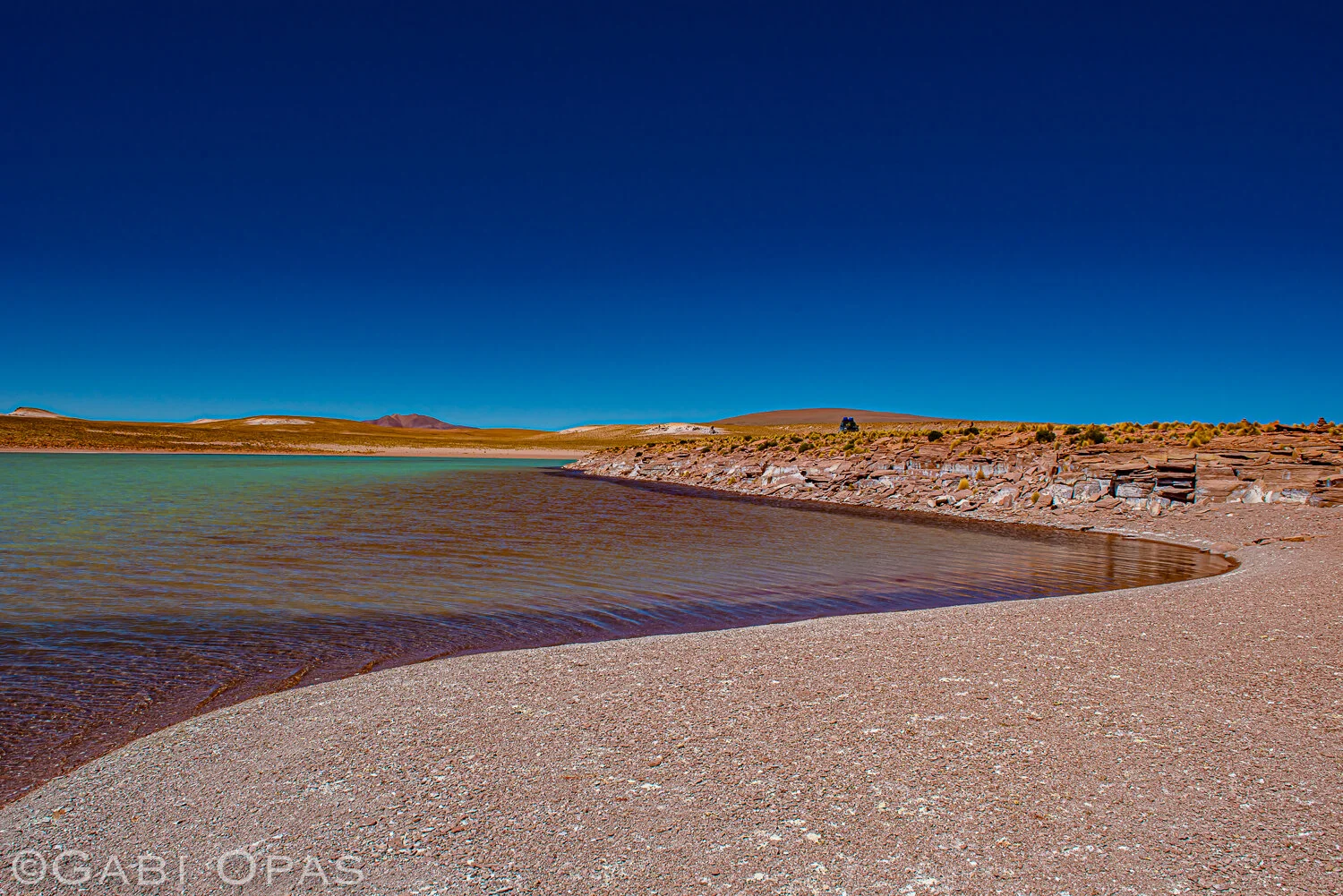
We continued South on the main road towards Volcan Uturuncu. Our plan was to circumvent it and camp at Laguna Celeste. Here the roads were almost inexistant. On the ascent, the disappearing road directed us to a maze of canyons. Mistakenly entering any of those would have surely ended the life of our 4x4. To safely navigate those, we had to use the drone to provide a global view of the landscape, and took a few cool pics while we were at it. At this point we had not seen a soul for a couple days and had zero connectivity. Any car breakdown or personal injury would have resulted in a multiday self rescue at best. Luckily our car managed to survive our major off-roading detour and we finally arrived at a beautiful lagoon where we set up camp.
It was only the next morning when we continued on our way that we came upon another lagoon, even more stunning than the first, when we realized we had mistaken the identity of the previous lagoon. The “real” Laguna Celeste – which literally translates to celestial lagoon – was exactly that – a pool of heavenly, crisp, vivid blue glacier water. The water was so inviting that Dan stripped down and dipped into this little piece of heaven on earth. I wasn’t as courageous and only opted for dipping my feet into the spectacular glacial waters.
Day 5: Laguna Cristal
We continued to loop around Volcan Uturuncu, and explored the surroundings. We walked to the edge of a cliff from which we had an impressive view onto a small salt flat, and we spotted flamingos in the distance. The swirling patterns of salt and other minerals in the earth, speckled with the flamingos like small ants created an astonishing design. We set up camp at yet another lagoon – my map deciphering indicated that it was called Laguna Cristal.
We were lucky to spot a group of vicunas, which in the 70s were considered endangered due to poaching for its highly valued wool. Luckily Bolivia and neighbouring countries have taken steps to ensure conservation and protection of the shy animal. Due to regulated trade, the population has rebounded in the last few decades and most of the profits from its wool supports the local communities and farmers.
Day 6: Termas de Polques
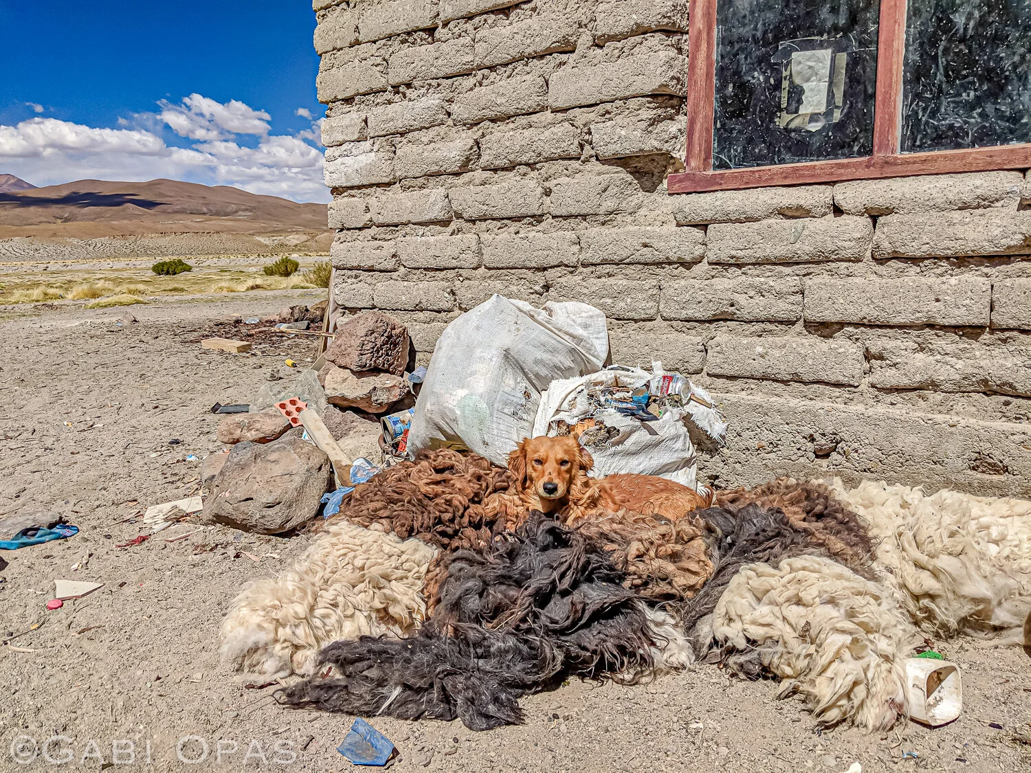
Having done almost a full circle around the Volcano, we directed Westwards towards our next destination. On the way we stopped in a small, dusty, windy village, Quetena Chico, where we tried to conservatively stock on more food and gasoline. The dirt road through town lead us to the main shop which had limited options – some instant noodle soup, chocolate wafers, and not much else. We asked a lady on the street if there was anywhere we could buy some gas – she motioned to follow her and she took us to her home, where she sold us a few litres of gas that we siphoned from her jerry cans to fill our tank, trying to keep our rooftop stock full. She then offered us a meal – fresh llama steak. Their dog napped in the llama’s fresh pelt drying out in the sun in front of her home, and its hooves laid at the entrance. The run-down hut comprised only of two rooms – one was the kitchen and the other served as a living and bedroom for the whole family. Despite their poverty she was welcoming and generous, offering a side of rice and fresh vegetables which are not easy to come by in those areas – and it was a welcome change from our daily pasta meals.
We continued on West and then South to Thermas de Polques, a 29.4C hot-spring pool. Since we couldn’t find a place to camp sheltered from the wind, we opted to rent a room in favour for a warm(ish) shower, hot coco tea and a real bed for the night. There’s nothing like dipping into a warm bubbling pool of steamy waters in the crisp morning surrounded by volcanoes.
Day 7: Dali Desert & Laguna Verde
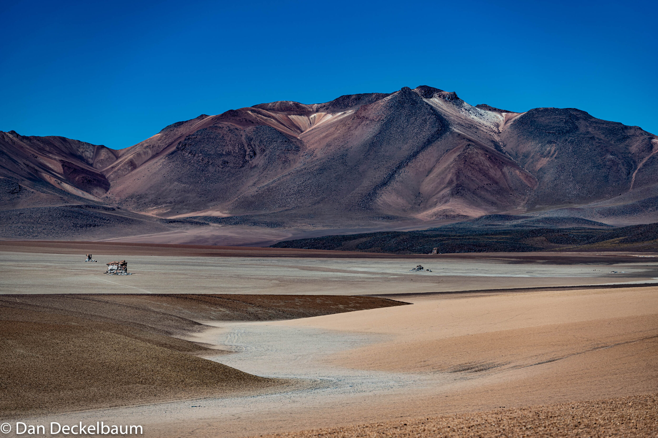
After a relaxing spa session provided by the hot thermal springs of the earth, we continued down to Laguna Verde, at the border of Chile. To get there you need to drive through the Salvador Dali Desert – it’s name is self-explanatory. Strangely shaped rocks sprawled out in a desert with surreal rainbow mountains as the background. On the way we spotted a lone wild Andean fox on the side of the road and managed to get some cool snapshots of it. From a distance we spotted Volcan Licancanbur and eventually Laguna Verde appeared stretched out in front of it. What an incredible sight – the tropical turquoise waters surrounded by frozen volcanoes. As the icy wind foamed up the lagoon, stirring the minerals in the water, the emerald green shade intensified. Because of the combination of minerals, the water can stay in liquid form even as temperatures drop to -50C. I cannot say the same for myself as I slowly turned into an icicle as we set up the tent and took shelter in it from the wind as soon as the sun went down.
Fun fact: “The upper reaches of Licanacabur have been used for NASA experiments to prepare for future missions to Mars. Scientists believe that the thin atmosphere, high ultraviolet radiation and varied temperature here are similar to Mars 3.5 billion years ago before the planet became incapable of holding life.”
Day 8: Sol de Manana
The following morning we started to make our way back up North, towards Sol de Manana – a geothermal area completely covered with bubbling geysers. The steam can rise up to 15m high – we saw it in the distance so we knew we were going in the right direction. As soon as we got out of our car the strong smell of sulphur hit our senses. Once again it seemed like we were on another planet - not on Earth. The variety of colour, texture and movement was like a beautiful conducted orchestra of nature. It’s a never-ending playground for a photographer. After hopping around for a couple of hours amongst they geysers, we eventually continued on our way towards Laguna Colorada and found a simple hostel to sleep at right before nightfall.
Day 9: Laguna Colorada
Until now we had seen mesmerizing blue, green, and white lagoons, but we were not prepared for what was in store next. Laguna Colorada has an intense red colour and depending on the light and your position, the colour could vary from a dark sangria burgundy to a light raspberry magenta. This is caused by the algae found in the lake, which also consists of the main diet for flamingoes which gather here in abundance. You can find three of the world’s six species of flamingos here: the Andean, Chilean, and James’ flamingo. The latter one was thought to be extinct until it was rediscovered in the 1950s, and is still considered endangered today.
Fun fact: “Flamingos are born with white and grey feathers, which gradually turn pink because of a natural pink dye called canthaxanthin which comes from the food they eat. The red algae in Laguna Colorada stains their feathers to a beautiful vibrant pink.”
Day 10: Salt Hotel
The previous evening we had driven from Laguna Colorada past more surreal desolate lansdcapes. Finally, we stumbled on a tiny village near the Southern part of the Uyuni Salt flats and found a charming little “hotel” made entirely out of Salt. All the walls, floors, bed, tables and chairs were built with salt blocks created by the locals from the Salt flats. What’s interesting is that these hotels usually only last about 10 years because of their disintegration caused by the elements. We were greeted at the entrance by a sweet baby llama who was recovering from a broken leg.
Day 11: Cacti and Quinoa
As we wrapped around the East side of the Uyuni salt flats, we noticed a change in vegetation which up until now was sparse. We spotted many humongous cacti, which grow 1 cm a year which means they are likely hundreds of years old. We managed to spot a falcon among the rocks and a fox hiding in the fields. As we reached the Northern part of the salt flat, the earth changed from rocky desert to fields of bright red quinoa, some already gathered into bundles. Bolivia and Peru together make up 99% of the world’s quinoa production, which is harvested only by hand.We set up camp near an abandoned building, and watched the kaleidoscope sunset turn into a star-speckled sky.
Day 12: Sajama National Park
We arrived in Sajama National Park named after Nevado Sajama Volcano which is the highest peak in Bolivia at 6,542m. We decided we would stay put for a few days to do some trekking and explore Bolivia’s oldest national park. We found a little hostel that had small traditional huts instead of rooms that would serve as our base. We decided to start off with a day hike to Mount Huisalla at 5,000m. Although we had somewhat acclimatized to the high altitude for nearly 2 weeks it was still an extremely difficult climb for me. I had never been at such a high altitude and with each step I could feel my breath getting quicker and my heart beating with effort. Slowly and steadily, with Dan’s encouragement who didn’t seem as affected by the altitude, we climbed to the peak where the sweeping views of the immense volcanoes dispersed around us were a much-deserved reward for persevering through the challenging ascent.
Day 13: Geysers and Hot Springs
The following day we took a day of rest to explore the park’s geysers and hot springs. We were once again in any photographer’s paradise, hopping from bubbling geyser to steaming spout, each one more colourful than the last. Dan started up a conversation with a local who indicated the directions to a private hot spring where we would be able to bathe in. Based on his vague description it took us a little searching to find it, but it was worth the effort. We floated in a crystal-clear sizzling pool of water while overlooking the sun setting over the majestic snow-peaked volcanoes surrounding us from all directions.
Day 14: Parinacota and Tomarapi
Dan set his sight on hiking Parinacota Volcano, which reaches an altitude of 6,348m. The guided hike starts at 2AM in order to reach the peak by morning, since shortly after the conditions become too windy and cloudy to ascend. Considering my struggle getting up to 5000m on my previous hike, which I was nevertheless quite proud of, I was unsure if I had the physical aptitude to succeed. I became even less enthused when I realized that the majority of the hike would take place at night when temperatures dip below 0°C. I decided I would pass and save my energy for another day. I think I made the right call, although I was a bit envious of Dan’s excitement after he came back from the intense trek and said it was the simultaneously the most miserable and most amazing experience. Luckily, he lugged his camera equipment up with him, so I was able to appreciate the breathtaking view through his photos.
That afternoon we headed over to explore the nearby village of Tomarapi. Consisting of an old church surrounded by a few houses, it was completely deserted when we drove in. We strolled around until we came upon a little baby llama followed by her owner, an elderly woman, who cast a wise and mysterious aura. She was clearly in charge – indicated by the ring of keys dangling from her hip, that she used to unlock the empty church. She then escorted us to a little museum that housed cultural artefacts, a stuffed alpaca, llama, vicuna, an armadillo, and showed us how a loom is used to create traditional textiles.
Day 15: La Paz Markets
After a little over two weeks, we finally came full circle back to where we started – La Paz. In much of a need of a long hot shower, a deep cleanse and laundry, we took the day to recuperate and reorganize. We felt a sudden jolt back into civilization after spending all that time secluded in the remote wilderness of the country. Strolling around the neighbourhood of Rosalia, we passed throngs of stalls selling anything and everything you can imagine. Each street was like a different aisle in a store; one had traditional textiles, another wooden sculptures, and another clay pottery. Around another bend, we discovered a kaleidoscope of fruits and vegetables. You could sample an endless variety of exotic fruit whose bizarre shape, taste, texture, and names seem to have sprung out of a book by Dr.Seuss: kinoto, maracuya, acerola, chirimoya, kaki, chuchu, tamarillo, carambola. If that weren’t strange enough, suddenly we noticed dehydrated snakes, frogs, and llama fetuses hanging amidst the stalls of souvenirs. We found ourselves in the middle of the mythical Witch’s Market – where locals purchase these dried animals as talismans to present as offerings to Pachamama, the counterpart of Mother Earth in ancient Incan mythology. In Andean tradition, during the construction of a new building, in order to offer protection for both the builders and future dwellers, usually a live llama is sacrificed on the land. For those that cannot afford such an expensive offering, burying a llama fetus in the ground serves as an alternative. We decided to backtrack to the textiles area where I chose a soft llama wool sweater – my substitute of a talisman – for protection from the harsh weather of future travels.
Day 16: Copacabana & Fiesta de la Cruz
The following day we set off towards the mystical Lake Titicaca – the largest lake in South America and the highest navigable lake in the world. We would spend one day in Copacabana – a usually peaceful fishing town, with not too much to do. But we had managed to coincide our visit with the celebration of Fiesta de la Cruz – an important festival that begins on May 3rd and lasts several days. The small town exploded with extravagant and bright costumes, synchronized dancing and singing, and boisterous brass music. Thousands of Bolivians, young and old, pilgrimaged from all over the country to take part in this spectacle, each of them twirling in a characteristic folk costume from the different regions of Bolivia. Everyone was covered from head to toe in an overwhelming combination of intricate lace, glittering embroidery, beaded fringes, and most either wore a traditional bowler hat topped with jewels or extravagant feathers. The midday-sun beat down on the sweating but smiling performers, and cans of beer were passed around to quench their thirst. As the day progressed, the crowds got rowdier, and what started as an orderly procession turned into a full-on party that continued to the crack of dawn.
Day 17: Isla del Sol
In the morning we made our way to the waterfront, passing several partyers who were still going strong from last night’s festivities. We were leaving the energetic festival behind and heading by boat towards the peaceful and serene Isla de Sol. Crossing Lake Titicaca in itself is a breathtaking experience – with a view of the Cordillera Real mountains looming over the still and glassy waters. We docked on the southern tip of the island, and then climbed our way up the never-ending steep trail to the top ridge of the island. Along the narrow paths were countless merchants selling a large variety of traditional multi-colored hand-woven textiles. With no cars on the island, the quiet enveloping us was a sharp and welcome contrast to the overwhelming noises that we had left behind. Each house had a large terrace looking over the rolling hills of fields, dipping into the smooth navy-blue lake. After a relaxing stroll, we followed the smell of freshly baked bread towards a small restaurant and sat down on its empty patio and ordered coca tea and dinner. As we gazed at the sun setting over the snow-peaked Cordillera Real mountain range, the blue sky transformed into a pastel-hued mirage, reflected in the sleek tranquil waters. Watching this phenomenon, I understood why the ancient Incan people believed that Lake Titicaca was the birthplace of the Sun.
Day 19: Cordillera Real
The 125km long mountain range of the Cordillera Real that soared over Lake Titicaca was our next and final stop. With only a couple of days left before our flight back home, we wanted to finish our trip with a bang. Our goal: Pico Austria, which is one of 600 peaks that reaches over 5000m in the Cordillera Real. The first of the two-day hike was a moderately easy and gradual climb past gushing waterfalls through a valley filled with grazing llamas and alpacas. Our first reward; Chiarkhota Lagoon, with dark emerald green water. In its background sore the impressive Condoriri Massif, which translates to Condor Head, because its peaks resemble that of a condor about to take flight. After lunch, we hiked a little further, past green mounds in frozen ponds to the base of the Pequeño Alpamayo glacier. This is where we would stay for the night and rest up for the next day’s challenging ascent.
Day 20: Pico Austria
I was already proud of myself for beating my previous record by reaching an altitude of 5000m when we were in Sajama National Park, and a week later I was ready to try to beat it again. Pico Austria at 5350m, is almost the same height as Everest base camp which is at 5364m. Starting at the crack of dawn, we set off on the steep and demanding trek to the peak. As we rose in altitude, reduced oxygen and sliding rocks under our feat added to the difficulty of the climb. When we finally reached the top, the clouds opened up around us and revealed the most breathtaking views. Now this is what “on top of the world” really feels like. On a clear day we would have been able to see Lake Titicaca in the distance, but the dense yet whispy clouds and their shadows added drama to the landscape. If it wasn’t for the freezing wind, we could have sat there all day, gazing at the infinite shapes and colours of the surrounding mountains, valleys, and lagoons. We took it all in. All of a sudden, a gloomy cloud came over the peak and it started to snow! We took this as a sign to start heading back down. At the very end of our trek, we were greeted by a rainbow that emerged out of the fog. I could not have imagined a better finale to our amazing 3 week adventure in Bolivia.
One of the things I learnt on this trip about travelling is sometimes its better to take your time to really experience a place instead of trying to tick off all your boxes on your bucket list. At first we were considering doing a trip encompassing all of Bolivia and even some of Peru - instead we decided that we didn’t want to rush through it and wanted to focus our attention on the Altiplano. In certain spots we met tourists who were taking 3-day trips through the Altiplano getting only a few minutes to snap a photo and move on to the next location. Maybe they saw more but can you really “see” more when you’re not really stopping to take in the beauty of your surroundings? When we saw someone else on our trip - which was quite rare - they wouldn’t be around for too long, which was great for us. On some stretches we went for days without seeing a soul. So my personal advice for travellers is, if you really want to get to know a place in depth, instead of rushing through a list of must-sees, take your time and focus on what you really want to see. You can take a picture - or more - but then put down the camera, take a deep breath, and really experience the wonderful world around you.


